Integrating your GIS data with AEC design software
My prior posting discussed imagery (either satellite or LIDAR) as a standalone solution in the AEC world. Today we’re going to dig a bit deeper into the integration of imagery into some of today’s most powerful AEC software tools. Once you’ve gone through the time and expense of identifying an area of interest (AOI), procuring the imagery and reviewing it for accuracy – why not integrate it into your design software? The screen shots below provide a nice comparison of a screenshot with and without imagery. Granted, you’ll want to be able to turn the imagery on/off based on the task you’re performing – but the benefits of seeing the terrain, buildings, roads and surrounding areas are clear.
 We’ll be discussing this in greater detail in a three part webinar series starting on April 21.

 We’ll be discussing this in greater detail in a three part webinar series starting on April 21.
Related Blog Posts

Business Applications, Digital Design
Transition periods are never easy. As businesses move from routine practices to uncertain situations, there’s a level of trepidation involved. Thankfully, there are ways to ease this anxiety—namely, by shedding light on the gap in old vs. new practices. At a time when many organizations are either in the middle of transition or running up against it, investment in visibility is imperative.
Nowhere is visibility more important than facility planning. Facility managers need oversight as they begin to adapt assets and workflows in the near-term and for the future.
Michael Willette

Business Applications, Digital Design
The COVID-19 pandemic has been disruptive to physical workplaces for so many reasons. One of the biggest challenges for businesses has been adapting offices to new and often equally disruptive safety standards – social distancing, sanitization, contact tracing, etc. While there’s keen emphasis on these practices, indoor air quality (IAQ) in many offices is only now getting the attention it deserves.
Michael Willette

Digital Design
Healthcare facility management is complex, especially since many organizations are open around the clock. Ensuring yours is at its best is expensive. Maintaining a building properly accounts for more than 80 percent of the total cost of operations and occupancy. Safety regulations constantly change. Patients arrive and depart on a variety of timelines. Healthcare workers regularly use spaces like break rooms and storage areas.
Michael Willette

Big Data & Analytics, Channel Partners, Digital Design
Does your business have a single source of truth when it comes to data sharing across facilities? Ensuring data is accurate, relevant, and structured is something any business can recognize as important, yet it is more difficult to achieve than most realize. Just because you are use an integrated workplace management system (IWMS) or have relevant GIS data doesn’t mean it provides a single source of truth.
Michael Willette

Channel Partners, Digital Design
This interview was originially posted by GovDesignHub here.
Brandon Norris

Digital Design
Article authored by Dan Williams and originally posted to GovDesignHub here.
On April 6, 2021, Autodesk Vault 2022 was released. And I have to say that it is easily the most feature-rich release in recent memory.
Brandon Norris

Digital Design
Prior to 3D printing’s arrival on the manufacturing scene, the US military supply chain was often met with lengthy and arduous timelines for critical asset production. This not only stalled the manufacture and repair of essential equipment within the military supply chain, but it also impeded military readiness, and with high price tags to boot.
Brandon Norris

Channel Partners, Digital Design
Americans spend about 90% of their time indoors, according to EPA reports. Whether it is their home, workplace, or another location, people depend heavily on a controlled environment. Everything from the air we breathe to the light we bask in is artificial or at least managed. In shared spaces, it is the responsibility of building owners and managers to provide healthy and safe workplaces.
Carly Bell

Digital Design
Out of sight, out of mind. It’s all too easy to forget about asset maintenance when the assets themselves aren’t right in front of you. During the COVID-19 pandemic, this became more evident as employees went home and logged into a virtual workplace instead of coming to a physical space.
Carly Bell

Digital Design
There are two distinct factions when it comes to working from home: those who relish it and those who despise it. Before COVID-19, working from home was a perk. When the pandemic hit, work-from-home (WFH) became a necessity to combat the virus’s spread. One person’s dream; the other’s nightmare.
As COVID-19 rolls on, employers are dealing with two sides of a war between those who want to return to the office and those who’d prefer working from home. Depending on who you ask, results are mixed:
Carly Bell

Digital Design
The modern workplace is a far cry from spaces of the past. Banks of private offices gave way to an open concept fad that’s morphed into a hybrid of spaces, including personal desks surrounded by pony walls, hot and hotel desks, and collaboration areas.
COVID-19 threw workplace and space management into turmoil, but the return-to-work movement is underway. As employees come back to offices, stores, factories, and other businesses, the need for privacy in the workplace again takes center stage.
Carly Bell

Digital Design
Mixed-use spaces – used by public sector agencies for different purposes – or even mixed-use cities present unique challenges for workplace managers under the cloud of COVID. Unlike single-use facilities, mixed-use spaces may see much larger groups of people come and go. Monitoring the health of every individual is likely impossible without strict contact tracing standards.
Carly Bell

Digital Design
Historic buildings hold a special place in the hearts of architects, workplace planners, and employees. There’s something alluring about creating workspaces within the confines of century-old stone or retrofitting a Victorian Era home into offices.
For all their uniqueness, repurposing historic buildings for modern workplaces isn’t as easy as replacing a few light fixtures and brushing on a new coat of paint. Most older structures are governed by sometimes-strict regulations overseen by historic districts – the first was created in South Carolina in 1931.
Carly Bell

Digital Design
Article originally posted to the GovDesignHub here.
Brandon Norris

Digital Design
Article originially posted to the GovDesignHub here.
Brandon Norris

Digital Design
One of the many challenges that organizations faced this year was the scaling of a remote work model. But with the prospect of life and work returning to normal in the coming months, those same organizations face a new challenge – scaling back up their facilities in a safe way.
To learn more about how facilities and space managers are planning for this prospect, I sat down for a Q&A with Nick Stefanidakis, Vice President of Field Sales & Enablement at SpaceIQ.
Brandon Norris

Digital Design
The benefits of the Internet of Things (IoT) are undeniable. IoT-enabled technologies collect data that impacts cost, productivity, compliance, and security. However, that data is only as good as the analyses derived from it, especially when it’s connected to how workplaces are populated, and space is managed today and in the future.
Carly Bell

Digital Design
Managing real estate for a single workplace is, in certain ways, simple. There is a single set of data for land, buildings, and leases. For companies with multiple properties or a global presence, the task becomes daunting.
A centralized data repository is the key to maintaining accurate and easily accessible information to manage real estate portfolios. But not all data systems are alike. Real estate planners and facility managers should consider several items when choosing a real estate portfolio management system:
Carly Bell

Digital Design
Let’s face it: the days of open offices are over. The pandemic likely drove the final nail in the coffin of a design fad that was all the rage but fails to meet the safety and productivity needs of today’s workplaces.
That’s no easy task in the face of a pandemic that shut the economy down for months and continues to wreak havoc. But employers are reopening workplace doors and welcoming employees back—and Archibus is ready to help with safe back-to-work transitions.
Carly Bell

Digital Design, IT Infrastructure
The more things change, the more they stay the same— especially when it comes to budgets and requirements. How does one keep up with it all?
It is crucial to track, manage, and analyze property and infrastructure information to maintain or reduce operational costs.
Here are a few tips to help you get the most out of your IWMS and keep up with all the changes thrown your way.
1. Collect as much (accurate) data as possible
Carly Bell

Digital Design
Another release of Civil 3D just became available, just as you probably finished installing the latest 2020 “fix.” That was somewhat sarcastic, but I do some see much needed improvements to Autodesk Civil 3D 2021 and all other 2021 products. But we can’t just look at what’s new in our hero product, but all other complimentary products as well, so I will briefly mention a few of those.
Civil 3D Version Interoperability
DLT Solutions

Digital Design
A new version of AutoCAD is now available.
DLT Solutions

Digital Design
From design, construction, to facilities management, the need for closer ownership is clear.
Shaun Gaffrey

Digital Design
The future of government offices, buildings, and installations is about to change dramatically. When workers return to work or building owners make changes to how they work, they can expect offices to be designed differently to minimize the spread of germs and make people feel safe. But we can also expect sanitation to step up significantly.
Caron Beesley

Digital Design
Digital design data is a big data business. It requires secure management and storage, versions need to be stringently controlled, and teams need to access files readily so they can share that data with stakeholders.
For too long, however, designers, engineers, and CAD managers have relied on traditional document management systems, like network drives, to achieve this. While they do a great job with office documents, those same solutions don’t work well with today’s design files and models, for several reasons:
Caron Beesley

Digital Design
AutoCAD 2021 is here!
On March 25, 2020, Autodesk announced the release of AutoCAD 2021 the latest iteration of its flagship software first released in 1982. A key update includes a new integration with Google Drive allowing users to access their designs wherever they are as well as performance enhancements.
Let’s break down what’s new.
Caron Beesley

Digital Design
Article originally posted to GovDesignHub here.
If you’ve made the move from AutoCAD to Revit, congratulations. But what do you do with that huge library of details that you amassed over years of working on CAD projects? As you transition to Revit, recreating AutoCAD details is a hassle and trashing them is out of the question.
The good news is, you can use details right in your Revit project – straight from AutoCAD.
Caron Beesley

Digital Design
Article originally posted to GovDesignHub here.
Building and maintaining our nation’s infrastructure is a critical responsibility of the public sector. Yet, year-after-year, the U.S. continues to rank low on the American Society of Civil Engineers (ASCE) Infrastructure Report Card.
Caron Beesley

Uncategorized
Article originally posted on GovDesignHub here.
Autodesk University (AU) returns to Las Vegas from November 19-21 – and we have some good news. In addition to discounted conference passes now available on GSA Schedule, Autodesk Certification exams are back at AU 2019!
Caron Beesley

Uncategorized
By Mav Turner, VP, Product Management, SolarWinds
For federal IT pros, moving to a cloud environment is a “when” rather than an “if” proposition. From the government’s recently released Report on IT Modernization, calling for agencies to identify solutions to current barriers regarding agency cloud adoption, to the White House’s draft release of a new “Cloud Smart” policy, which updates the “Cloud First” policy introduced in 2010; cloud migration continues to be a priority.
DLT Solutions

Digital Design
Smart cities have been called “the future of urban development”, but what is a smart city and what does it mean to digital designers and engineers?
Kirk Fisher

Federal Fiscal Year End, Uncategorized
The old business adage runs, “Nothing happens until somebody sells something.” To which you might add this corollary: nothing good happens in the absence of strong requirements.
Brian Strosser
IT Perspective, Uncategorized
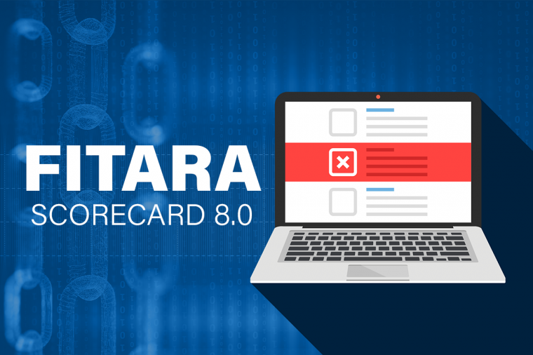
The latest data on the progress of federal government agencies’ implementation of the Federal Information Technology Acquisition Reform Act (FITARA) was released on June 26 by the House Oversight and Reform Committee as Scorecard 8.0.
Melissa Perez

Cloud Computing, Uncategorized
Key takeaways show how public sector customers are achieving more with cloud.
As cloud continues to transform the public sector, cloud has had its own metamorphosis: from a trendy buzz word to a catalyst for meaningful change, innovation, and more. Last month, AWS hosted its 10th annual AWS Public Sector Summit. The conference brought together more than 17,000 attendees for 2+ days of insights, sessions, and networking, and explored how cloud is fueling the public sector for a limitless future.
Recap
Isabella Jacobovitz

Uncategorized
Many states' fiscal years are quickly coming to an end, and at DLT we’re committed to making the job of the procurement officer as easy as possible as they scramble to make smart and responsible purchasing decisions with remaining taxpayer dollars. Part of this process is raising awareness of what’s new in our extensive portfolio of IT solutions including big data and analysis, cloud, cybersecurity, application lifecycle, digital design, IT consolidation and management, and more.
Brian Strosser

Uncategorized
Earlier this year DLT announced they were selected as the “Master Government Aggregator”
DLT Solutions

Business Applications, Uncategorized
Not all Ivy League schools have massive endowments and bank accounts. Some have to get more creative when looking to build new facilities on a budget – or simply embrace innovative new approaches to design and construction.
DLT Solutions

Business Applications, Uncategorized
It’s that time of year again! Spring is here and Autodesk has commenced its steady roll-out of 2020 software releases.
First off is AutoCAD 2020. Released in late March 2019, AutoCAD 2020 includes interesting and exciting new features. With a subscription to AutoCAD 2020, you’ll get industry-specific toolsets; improved workflows across all your devices – web, mobile, and desktop; and new integrations with cloud storage vendors.
Here’s a round-up of what’s new.
Kirk Fisher

Digital Design
Autodesk made further strides into its quest to empower the technological transformation of the construction industry with its recent acquisition of BuildingConnected – a leader in preconstruction tools that help building owners and contractors streamline their operations and communicate better.
Caron Beesley

Big Data & Analytics, Digital Design
The state of our nation’s infrastructure is grim. The most recent report card from the American Society of Civil Engineers (ASCE) gave U.S. infrastructure an overall score of “D” for “poor” or “at risk”.
Caron Beesley

Digital Design
If your job involves capturing existing field conditions as part of the design and construction process, you’ll know it’s a tedious, manual, often analog and inaccurate process, which often leads to costly re-work.
Whether you’re renovating a building or involved in a large-scale infrastructure project, the process goes something like this:
Holly Chapman

Digital Design
As any surveyor or field engineer knows, capturing existing field conditions for an infrastructure project or building renovation is a tedious, manual, often analog, and inaccurate process – not to mention dangerous.
Renovations projects are a particular challenge since the infrastructure or building may be decades old and designed before the age of digital blueprints. You’re almost guaranteed to start a project using static 2D image documentation of existing conditions. Verifying and updating these manually is a lot of leg work.
Holly Chapman

Digital Design, Uncategorized
When we launched GovDesignHub in the spring of 2018, we had one goal in mind – to address the lack of resources, discussion, and analysis available online for those who practice in government digital design ecosystem.
Today, we’re proud to be the only website that showcases government design projects and the technology used to support them and deliver content to help public sector organizations accomplish their missions.
In the words of one of our top contributors, Lynn Allen, of Autodesk fame:
Holly Chapman

Digital Design
What do a Facebook data center, a railway, an expressway, an office building extension, and a cancer center have in common?
These and other global projects are recipients of this year’s AEC Excellence Awards in recognition of how they’ve embraced technology to reimagine the processes of design and construction.
Holly Chapman

Federal Fiscal Year End, Uncategorized
Congress first enacted federal appropriations law in 1809. It’s kept lawyers, contractors, and judges busy ever since. A question arising in many sellers’ minds at this time of year is, what money is available for contracts in more than one fiscal year?
Tom Temin

Digital Design
Want to win a free pass to Autodesk University (AU) 2018? Earlier this summer, we announced that we’ll be awarding a full conference pass for you or a chosen nominee at your agency or department to attend Autodesk University 2018 in Las Vegas from November 13-15th.
Holly Chapman

Digital Design
Autodesk introduced its Autodesk Collections a couple of years ago and there’s never been a better time to make the switch from individual product subscriptions to a collection. Thanks to a limited time offer from Autodesk, your agency can save 20% on the remaining months of your existing term if you switch by October 25, 2018.
But what’s the buzz about collections and why make the move?
Why Make the Move to Autodesk Collections?
Holly Chapman

Digital Design
It’s that time again, when agencies rush to spend their remaining year-end budget before the September 30th “use it or lose it” deadline. One-third of federal budget dollars are spent in the last quarter of the year, often in a wasteful manner. But for those in the field of digital design – there are many opportunities to make value-based investments using taxpayer dollars before it’s too late.
1. Training
Holly Chapman

Digital Design
Download the eBook here!
If you’re one of the millions of people who’ve been lucky enough to hear Lynn Allen present, you’ll know her as the queen of AutoCAD tips and tricks and all-round Autodesk technical evangelist, but she also knows quite a bit about the latest disruptive technology – BIM.
Caron Beesley