CAD News for Govies is a weekly feature on Acronym that scans thousands of industry articles to present you with a regular source of CAD and GIS news, information and ideas that impact the public sector. Here’s the latest round-up:
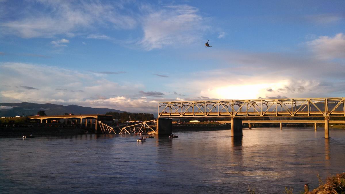
5 Reasons Bridges Fail
Bridge collapses seem to becoming more commonplace, but why do they fail in the first place? Better Roads has identified five big reasons contributing to bridge failure and collapse. Knowing these various reasons will help us appreciate architectural wonders and observe necessary precaution when maintaining and building a bridge. Read more.
What Causes the Most Damage to Bridges?
Speaking of vulnerable bridges, Better Roads recently announced the results of its annual survey on the state of the nation’s bridges. Bridge engineers from every state and Washington, D.C., were sent a survey with both qualitative and quantitative questions to determine the percentage of structurally deficient and functionally obsolete bridges by state, by total state and interstate, and by city/county/township. So what causes the most damage – age, corrosion, traffic or other factors? Check out the results here.
6 Tips to Ease Your Transition into BIM
By now, you’ve probably heard more than you could have imagined about the possibilities of BIM for structural engineering. You might even be convinced of the benefits: intelligent models, auto-generating floor plans and sections, and better collaboration with stakeholders. But how do you actually get started?
BIM is complex, but is alsoa giant sea of potential. And if you leap in without proper preparation, you could drown in the details. Instead, with a little thought and planning, you can chart a course that will carry you safely across the BIM ocean. (Too many water metaphors?) Line / Space /Shape offers six tips to help ease your transition into BIM.
Master AutoCAD Palettes with Lynn Allen (Video)
We use AutoCAD palettes all the time — but are you a Palette Master? In this video tip from Cadalyst and Lynn Allen, you'll learn all the ins and outs of palettes, including transparency and docking, and see how to set them up for maximum productivity! Watch it here.
Webcast: The Power of Mapping for Enhanced Emergency Response (Dec 12)
If you’re a GIS professional or involved in emergency management or response, don’t miss this free webcast hosted by Google partner, DLT Solutions, on how familiar low-cost, cloud-based, Google GIS tools can help aid in the accelerated deployment of multi-layered, common operating maps to visualize incident-related information in real-time. The webcast takes place on Thursday, December 12 at 2 PM EST. Register here. You might also want to download this related free e-book: Google Emergency Response Tools for Govies.
Infrastructure Webcast: The Engineer – Streamlining Project Success with Data Clarity and Transparency (Dec 19)
Another free event you don’t want to miss this month is the last in a series of webcasts highlighting best practices and case studies in infrastructure project success. Hosted by DLT Solutions and Autodesk, The Engineer – Streamlining Project Success with Data Clarity and Transparency addresses the numerous challenges that today’s engineers encounter in the creation and management of designs for infrastructure modernization. You will see how state and local engineers for Snohomish County Public Works, WA; El Dorado County Department of Transportation, CA; and the City of Riviera Beach, FL used Autodesk Infrastructure Design Suite tools to stay in control of their design and help solve the data, communication, and design challenges to keep projects moving forward, within budget and on target. Learn more and register here.
Creating an Autodesk Revit Building Pad
So you have a terrific building and your site’s terrain modeled, and consequently, a grassy slope is running through your building lobby. This just won’t do! That’s where the Revit building pad comes into play. Even though the dirt should be retained at the exterior of a building’s wall, Revit doesn’t catch on to that. You need to tell Revit where the boundary of your building is so that it knows to cut a void out of the terrain. Curt Egli, Synergis Building Solutions Engineer, explains more in his guest blog.
Image courtesy of roswellsgirl (Flickr)
Related Blog Posts