
Digital Design
Can you believe it? It's that time again. Registration for this year's Autodesk University opens on September 12, 2013.
While the event isn't until December 3-5 at the Venetian Hotel, Las Vegas, you might want to take advantage of early bird rates as soon as they come online.
Can't make it to AU this year? You can still access past courses online, just sign-up for free to become an AU member.

Digital Design
CAD News for Govies is a weekly feature on Acronym that scans thousands of industry articles to present you with a regular source of CAD and GIS news, information and ideas that impact the public sector.
Here’s the latest round-up:
Webinar - BIM without Buildings? Yes, It’s Possible!
Digital Design
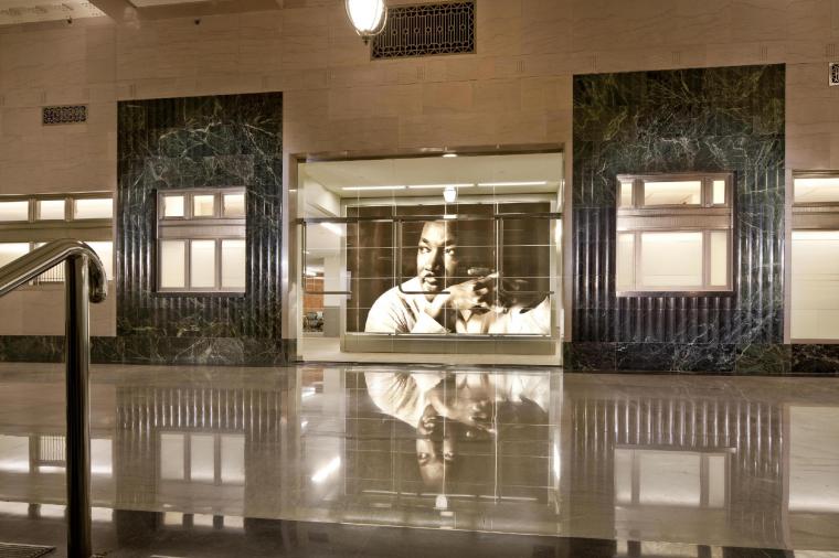
When the U.S. General Services Administration (GSA) wanted to renovate the Martin Luther King, Jr., federal building (MLK) in downtown Atlanta, a Depression-era building that originally served as the central postal facility for the Southeast, sustainability was an important part of the process. The $62 million renovation and rehabilitation of the MLK building, overseen by architecture firm Lord, Aeck & Sargent, was completed in 2011 and achieved LEED Gold certification from the U.S. Green Building Council.

Digital Design
CAD News for Govies is a weekly feature on Acronym that scans thousands of industry articles to present you with a regular source of CAD and GIS news, information and ideas that impact the public sector.
Here’s the latest round-up:
Autodesk Launches Four New 360 Applications
Cybersecurity, Uncategorized
During this panel, experts compared and contrasted security risks, responsibilities, and approaches of on-premise IT and the shared security model of the public cloud. Conversations explored topics from FedRAMP, shared resources, continuous monitoring, data management, and automation.
Cybersecurity, Uncategorized
Jim Wiggins is the Executive Director of the Federal IT Security Institute (FITSI). FITSI is a non-profit organization that provides a role-based IT security certification program targeted at the federal workforce. Jim was a keynote speaker at our recent GovDefenders Cybersecurity Virtual Event. His presentation was, “Building the Next Generation of Cyber Defenders" which you can now watch for free.