
Digital Design
CAD News for Govies is a weekly feature on Acronym that scans thousands of industry articles to present you with a regular source of CAD and GIS news, information and ideas that impact the public sector.
Here’s the latest round-up:
New Construction Management Software Designed Around iPhone Usability
Digital Design
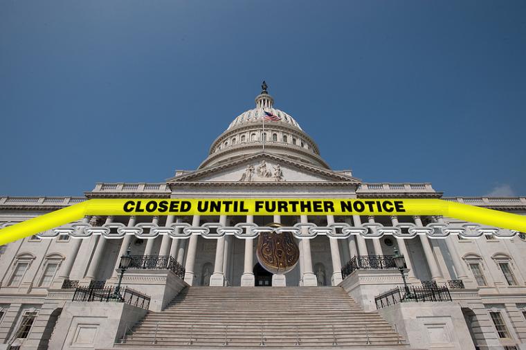
Earlier this week we shared an interactive graphic depicting the far-reaching impact of the government shutdown across the country. As we head into the end of the second week of the 2013 shutdown, here’s a look at how the protracted furloughs and closures are beginning to impact the government design/build industry both at the federal and state and local level.
Here’s what you need to know:

Digital Design
CAD News for Govies is a weekly feature on Acronym that scans thousands of industry articles to present you with a regular source of CAD and GIS news, information and ideas that impact the public sector.
Here’s the latest round-up:
Google Maps API Shows Which Gov Workers are affected by the Shutdown
Digital Design
CAD News for Govies is a weekly feature on Acronym that scans thousands of industry articles to present you with a regular source of CAD and GIS news, information and ideas that impact the public sector.
Here’s the latest round-up:
Autodesk Rentals – What’s the Benefit of Pay-as-you-Go?

Digital Design
One of the biggest challenges that first responders face when dealing with the aftermath of a disaster is sharing GIS data across disparate IT systems. It’s a problem we discuss extensively in this free ebook – Google Emergency Management Tools for Govies.

Digital Design
CAD News for Govies is a weekly feature on Acronym that scans thousands of industry articles to present you with a regular source of CAD and GIS news, information and ideas that impact the public sector.
Here’s the latest round-up:
SimCity with Real Data: Modeling Real Cities in 3D in a Web Environment