Digital Design
How does AutoCAD 2015 streamline cloud integration? Roundabouts or intersections – which traffic control device should you choose?
These and other stories are featured in this week’s CAD News & Tips for Govies, a weekly feature on Acronym that scans thousands of industry articles to present you with a regular source of CAD and GIS news, tips, events, and ideas that impact the public sector:
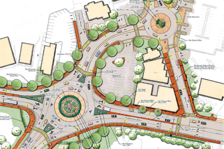
Roundabouts and Intersections: Two Traffic Control Devices, Many Options

Digital Design
Are you spending too much time keeping track of you design data? You didn’t become an engineer to manage data, so don’t. Autodesk® Vault data management software helps design and engineering workgroups to securely organize, manage, and track their data. Enjoy more control over design data with change and revision management capabilities. With Autodesk Vault, users can quickly find and reuse design data and more easily manage design and engineering information.
Digital Design
CAD News & Tips for Govies is a weekly feature on Acronym that scans thousands of industry articles to present you with a regular source of CAD and GIS news, tips, events, and ideas that impact the public sector. Here’s the latest round-up:

Digital Design
If you’ve ever accidentally moved a linked model or deleted a bunch of column grids in older versions of Revit and found your whole world crashing down around you, then you’ll want to know about these practical ways to keep your project intact a
Digital Design
CAD News & Tips for Govies is a weekly feature on Acronym that scans thousands of industry articles to present you with a regular source of CAD and GIS news, tips, events, and ideas that impact the public sector. Here’s the latest round-up:
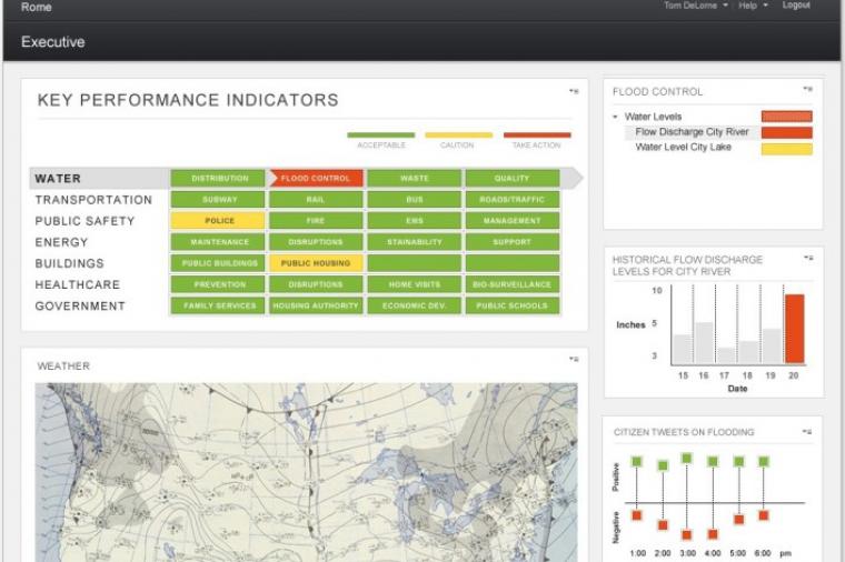
First City in the World To Manage Its Water Systems In The Cloud

Digital Design
AutoCAD 2015 is here! To help you navigate the new and exciting features of the new release, Donnie Gladfelter (aka The CAD Geek) runs through some of the top reasons to choose AutoCAD 2015.
One-Click Product Updates