How to Improve the Performance of Large AutoCAD Civil 3D Surfaces

From grading to storm and sanitary sewer design, AutoCAD Civil 3D Surfaces serve as a foundation for nearly all aspects of a typical civil engineering project. Given the far reaching impact of AutoCAD Civil 3D Surfaces, it's important to keep your data as lean as possible as not to negatively effect your projects performance. There are several ways to accomplish this including the best practice of limiting the total number of surfaces contained within any one drawing.
Although these best practices will go a long way to maintain the performance of your AutoCAD Civil 3D project, it's still not enough for some larger projects. If you have a very detailed surface, or one that covers a large area, that surface will likely impact the performance of any drawing it is referenced into. To better manage situations like this one, AutoCAD Civil 3D has a Level of Detail feature that you can choose to enable or disable as needed.

You can enable or disable the Level of Detail feature from the expanded Views panel of the View tab within the AutoCAD Civil 3D Ribbon. Expanding the Views panel will display the Level of Detail tool. Like other toggles inside AutoCAD Civil 3D, the Level of Detail feature is enabled whenever this button has a blue background, and disabled whenever it has a gray background.

The above warning will display when you enable the Level of Detail feature. This warning is simply telling you AutoCAD Civil 3D will selectively display a subset of the data composing your surface based on your current zoom level. For instance, if you were to perform a Zoom Extents to display your entire project, AutoCAD Civil 3D would display less data than when you were zoomed into a specific storm inlet.
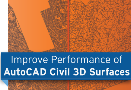
To demonstrate this, the above image shows an existing ground surface with the Level of Detail feature disabled on the left, and enabled on the right. Although the Level of Detail feature will selectively display a subset of the surface data contained within a drawing, it's important to note the original surface definition remains intact.
Since the Level of Detail feature will impact the way surfaces display, we do not recommend using it when performing tasks such as grading when its imperative to know exactly how a surface is triangulating. On the other hand, the Level of Detail feature is an incredible way to boost AutoCAD Civil 3D performance for most other surface-related tasks. Since the original definition remains intact, the Level of Detail feature is safe to use when performing tasks such as setting the Rim elevation for pipe structures.
Maintaining the performance of your projects is paramount if you're to deliver them on time. Our team of AutoCAD Civil 3D experts specialize in helping design teams develop strong workflows that allow you to do just that. To learn more about the ways our team of experts can help your team, please contact us at: http://www.caddmicrosystems.com/request-information.
By Donnie Gladfelter, CADD Microsystems
About Donnie Gladfelter
 Donnie Gladfelter (aka The CAD Geek) is a highly visible and respected thought leader in the CAD community. He is well-known for his CAD Geek blog (www.thecadgeek.com), as author of the book AutoCAD 2011 and AutoCAD LT 2011: No Experience Required, and is a popular speaker at Autodesk University and other industry events. He has worked with the development team at Autodesk to help shape future versions of AutoCAD, and the company has featured him in numerous video interviews, including their popular “Ask the Expert” series. Donnie also helps empower CAD professionals by providing training and services to companies around the world, and is a member of the Autodesk User Group International (AUGI) Board of Directors.
This blog was originally published on the CADD Microsystems blog and is reprinted here with kind permission.


