4 Inefficiency Traps that Civil Infrastructure Teams Need to Escape from in 2018
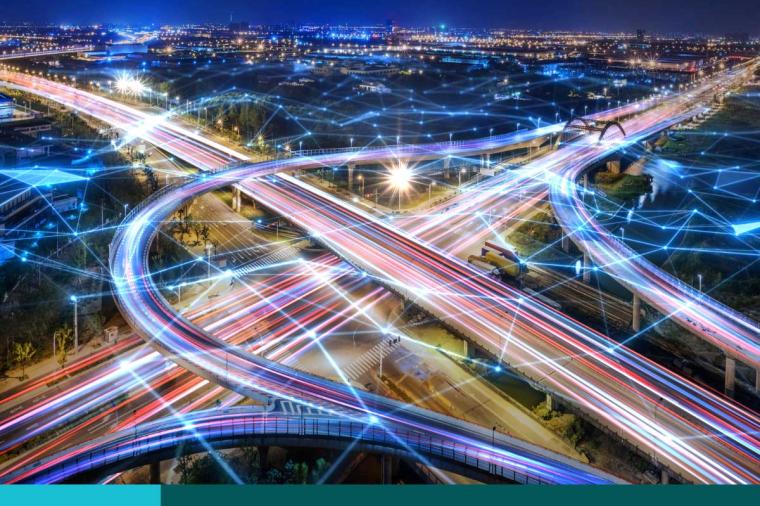
Urban development is a big challenge for governments and project owners. Urbanization, combined with overall population growth, could add another 2.5 billion to the world’s urban centers by 2050. For the infrastructure sector, this means providing the essential utilities and transportation systems to support these dense over-crowded areas – while doing more with less.
Technology plays an important role in the delivery of these projects. Reality capture and augmented reality can help you visualize how projects will look in the existing environment – saving costly re-work down the road. IoT can help collect and analyze data in real-time so teams can better assign assets and enable manage buildings and infrastructure more efficiently. Meanwhile, cloud computing is quickly becoming the backbone of the design process, creating opportunities to facilitate design iterations, analysis, and better collaboration.
Yet, the old way of doing things is holding the public sector back. In a new eBook – Break Free from the Inefficiency Trap – Autodesk has identified four inefficiency traps that federal, state, and local agencies often fall into, we’re hoping 2018 will change all that:
Trap #1: A Limited, Two-Dimensional View
2D CAD tools have their place, but don’t help with concept design or rapid prototyping, and make it hard to explore the full range of design options. Alternatively, consider adding model-based design to your toolkit in 2018. Building information modeling (BIM) isn’t just for buildings, it brings project data together to generate an intelligent 3D model that can be shared by designers, engineers, and other stakeholders throughout the lifecycle of the project and then used to support the constructed asset.
With this model-approach you can more easily address competing design parameters, test the viability of different approaches early in the design phase and correct potentially costly errors. As a civil engineer, you can model different types of intersections and roadway configurations, use simulations to show actual traffic volumes at different times of day.
It all makes for a faster and more efficient workflow.
Trap #2: Design in Isolation
The components of an infrastructure project only make sense when they come together, so why design them in isolation? Make 2018 the year when you experience improved collaboration with team members at the earliest phases of a project and better ensure your designs are feasible from the outset. Thanks to cloud-based 3D models, you have a central place to work through the design, and everyone collaborates on the same model in real-time – from anywhere.
Trap #3: Uninspiring, Incomprehensible Presentations
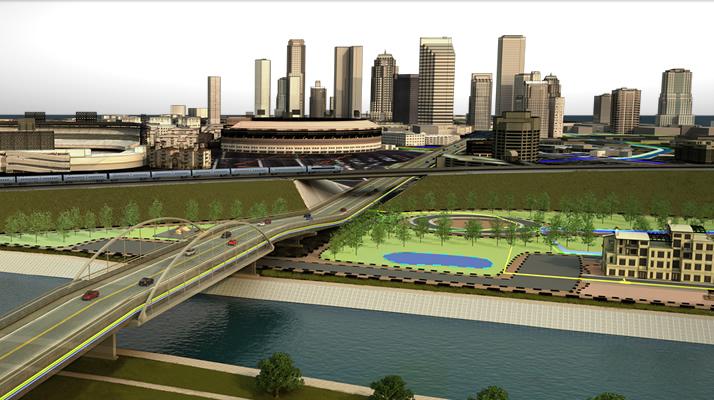
2D drawings are limiting, particularly if you’re trying to communicate design intent to stakeholders and the public. No matter how small your team, rich design models make it possible to create full 3D renderings and interactive experiences to share what your final designs will look like, whether it’s a roadway or a park. You can even overlay these designs on a model of existing conditions to create a realistic depiction of what your infrastructure will look like in situ.
Check out this example from the New Mexico Department of Transportation.
Trap #4: Design Divorced from Reality
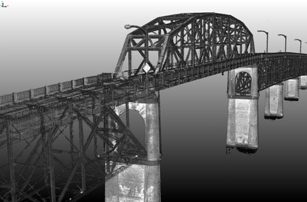
Conventional topographic surveys take time, while inputting this data in design programs can take even longer. This means, as a designer, you don’t always have the clearest picture of your project’s reality. But, if you use LiDAR reality computing lets you capture spatial information about the physical environment of your project through photography, laser scanning, existing geospatial and survey data, and more. Then you can integrate this data about existing conditions into the design model. A point cloud provides detailed ground-surface measurements, as well as accurate representations of assets like lamp posts, storm drains, curbs, signs, overpass and underpass clearance and complexity, and surrounding vegetation.
Below is an example of a point cloud of Manette Bridge, Washington, courtesy of Washington State Department of Transportation.
Next Steps for 2018?
There’s never been a better time to make the transition to model-based design processes, and we’re here to help.
Contact us (1-800-262-4DLT or email autodesk@www.dlt.com) to learn more about Autodesk’s Architecture Engineering & Construction (AEC) Collection which enables you to adopt 3D, model-based BIM processes more efficiently and effectively. With the AEC Collection, you have a broad portfolio of BIM technologies along with CAD-based toolsets, allowing you to make the move on your terms. And, capabilities for more interoperable model-based workflows supported by mobile and cloud technologies, mean greater insights into all phases of your project lifecycle.
Related Blog Posts