Digital Design
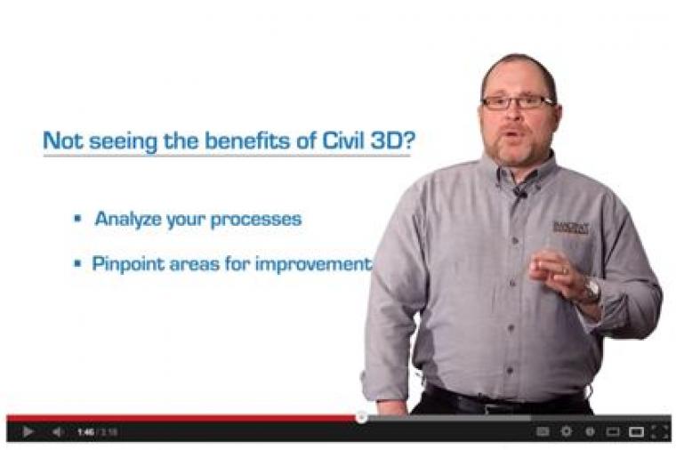
Is your Civil 3D process as efficient as it could be? Are you struggling to see improvements in your processes since adopting Civil 3D?
Digital Design
CAD News for Govies is a new feature on Acronym that scans thousands of industry articles to present you with a regular source of CAD and GIS news, information and ideas that impact the public sector.
Here’s the latest round-up:
Some Favorite Tools for Simplifying CAD Management
Digital Design
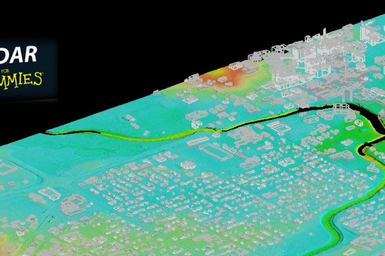
LiDAR, a remote sensing system used for mapping the surface of the earth, has been around for decades, but it’s only in the past few years that it’s undergone a boom and is now at the heart of many government data gathering projects – from mapping desert terrain in Afghanistan to creating forest height maps.

Digital Design
Government agencies at all levels are finding that managing electronically stored information (ESI) is a challenge. Volumes of electronic data are growing, while agency budgets are shrinking or remaining level. Solutions like Rand Secure Archive can solve data storage challenges for government agencies in a cost effective way.

Digital Design
CAD News for Govies is a new feature on Acronym that scans thousands of industry articles to present you with a regular source of CAD and GIS news, information and ideas that impact the public sector
Digital Design
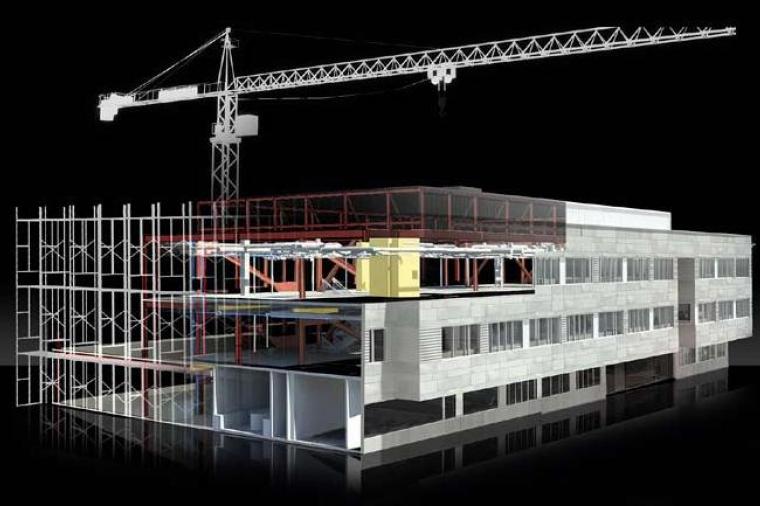
Despite its name, the many benefits of building information modeling (BIM) are no longer restricted to the architecture and building industry. BIM is quickly establishing a foothold with civil engineers, public sector transportation, and infrastructure officials as a tool to deliver design projects faster and smarter thanks to technology like AutoCAD® Civil 3D® and Autodesk® Infrastructure Design Suite (a comprehensive software solution for planning, designing, building, and managing civil and utility infrastructure – also known as the ultimate “BIM for Infrastructure” solution).