Maine EMA Uses Google to Streamline Emergency Management Tasks Statewide on a Virtual Globe

 When a state or region experiences a major weather event such as a hurricane, blizzard or tornado, numerous agencies and organizations must work together to manage the crisis. For instance, when Hurricane Irene battered the U.S. East Coast in August 2011, thousands of workers were called into action, including fire and rescue personnel, utility workers, public health officials and workers at all levels of state and local government. Typically, each of these groups maintains its own geographical data, tracking a storm, flood or other disaster, and working in a silo to ensure its own portion of the rescue and recovery is completed.
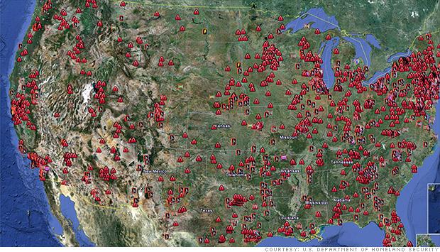
But new technology makes it easier to share data across a standard platform, allowing these diverse groups to truly collaborate and communicate in real time about damages and recovery progress. The Maine Emergency Management Agency (MEMA) used Google Earth Enterprise to develop Virtual Maine (vMaine), a comprehensive common operating picture that layers location-based information onto a single virtual globe. MEMA is in the process of deploying vMaine to 700 people across all levels of state and local government, and each will be able to use the tool to securely visualize GIS data. The tool helps public safety and emergency personnel improve their performance in response to emergencies, as well as in daily operations, said Christopher Kroot, manager of GIS applications for the Maine Office of GIS, in a recent webinar sponsored by DLT Solutions.
The vMaine system allows various agencies to integrate their geographic data and incorporates FEMA alerts, electrical outages, closed streets and roadways, and even details about hospitals, nursing homes and other critical facilities in the affected area and available resources nearby. Because the system is mobile, emergency workers can access vMaine on their phones or other mobile devices while in the field to see what areas have already been covered by first responders and which ones are still in need. The system is also integrated with Red Cross data, so it includes all kinds of necessary information such as the locations of emergency shelters, which can be updated with real-time availability.
After evaluating several different platforms for developing the vMaine geographic tool, both users and the technology team chose Google, Kroot says. The users preferred it because it was simple to use and most people already know how to use it. Techies selected the platform because it’s usable off the shelf and there’s no need to develop a new application.
Other emergency management organizations have found Google Geo Solutions equally helpful in designing their own solutions, says Jennifer Montano, enterprise geospatial manager at Google. The State of Florida uses Geo Solutions to make information available to the public before, during and after weather events. Alabama used the Google tools to develop Virtual Alabama, an affordable, easy-to-use system that allows users to visualize infrastructure and resources across 550 agencies. And the San Diego Red Cross uses Geo Solutions to maintain real-time information; share documents, maps, and data; and provide alerts, task planning, resource tracking and performance metrics during a disaster.
According to Alex Tinsley at DLT Solutions, Google Geo Solutions is enjoying success among numerous emergency management applications because it:
- Is simple to use and most users are familiar with the platform already.
- Is mobile and workers can take it with them anywhere.
- Supports community engagement and makes it easy to share information with the public.
- Is cost effective because it uses existing resources and data.
- Can be secure.
- Allows users to optimize a common operating picture.
Learn more about Google Geo Solutions by viewing the webinar, “Google Earth Reveals the Bigger Picture in Emergency Response,” which highlights vMaine and includes presentations from Google engineers, sponsored by DLT Solutions. Click here to download.
By Nancy Mann Jackson
Nancy Mann Jackson is a freelance journalist who writes regularly about local government and sustainability issues. Learn more about her at www.nancyjackson.com.


