CAD News & Tips for Govies 4/17
CAD News & Tips for Govies is a weekly feature on Acronym that scans thousands of industry articles to present you with a regular source of CAD and GIS news, tips, events, and ideas that impact the public sector. Here’s the latest round-up:
CAD & GIS News for Govies 12/6
CAD News for Govies is a weekly feature on Acronym that scans thousands of industry articles to present you with a regular source of CAD and GIS news, information and ideas that impact the public sector. Here’s the latest round-up:
5 Reasons Bridges Fail
CAD & GIS News for Govies 11/20
CAD News for Govies is a weekly feature on Acronym that scans thousands of industry articles to present you with a regular source of CAD and GIS news, information and ideas that impact the public sector. Here’s the latest round-up:
Is it Possible To Design Buildings That Can Withstand 250 MPH Typhoon Winds?
New eBook - Ubiquitous Tools from Google can Help Emergency Management Personnel Before, During and After a Crisis
[caption id="attachment_4375" align="alignright" width="300"]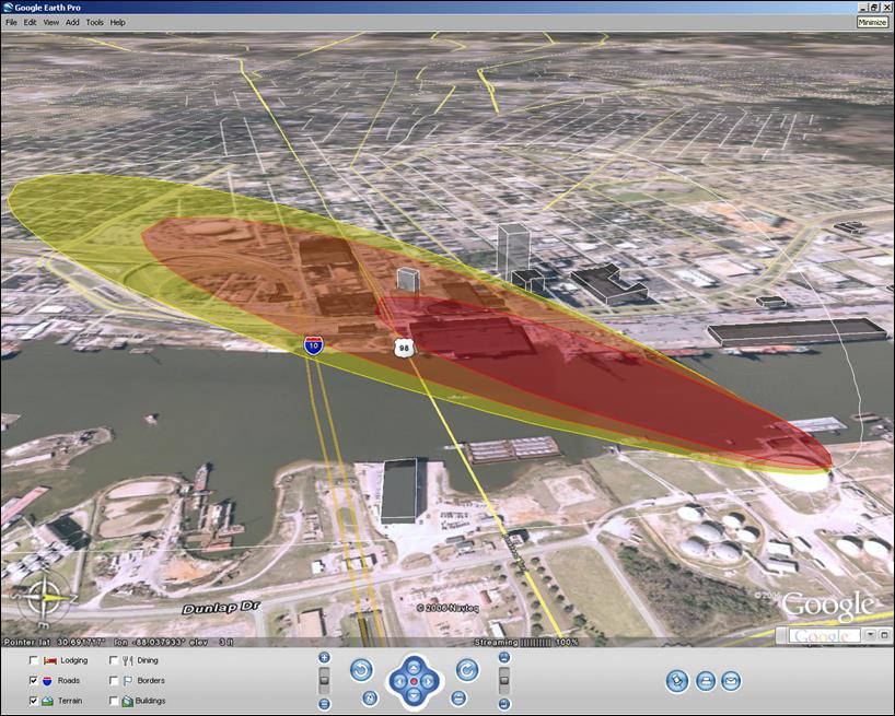 A red and yellow cloud plume overlaid on a Google Earth aerial map helps first responders assess and rehearse for disaster scenarios.[/caption]
CAD & GIS News for Govies 7/10
CAD News for Govies is a weekly feature on Acronym that scans thousands of industry articles to present you with a regular source of CAD and GIS news, information and ideas that impact the public sector.
Here’s the latest round-up:
Crisis Cleanup Mapping Tool Coordinates Rebuilding Efforts