LiDAR, a remote sensing system used for mapping the surface of the earth, has been around for decades, but it’s only in the past few years that it’s undergone a boom and is now at the heart of many government data gathering projects – from mapping desert terrain in Afghanistan to creating forest height maps.
LiDAR can scan everything from the ocean floor to forest undergrowth – all from an airborne laser pointed at a targeted area on the ground. Airplanes and helicopters are the most commonly used platforms for acquiring LiDAR data over broad areas and are equipped with a LiDAR instrument consisting of a laser, a scanner, and a specialized GPS receiver.
But what do you do with all that data once it’s been collected?
The good news is that processing LiDAR data involves the same tools regardless of the original scanning technology you used. The task starts with pre-processing which involves pulling the following data from the system in sequence, first the laser data, then the positional raw data, followed by the ground base station data, and lastly, the raw GPS and inertial measurement unit (IMU) data. Then the data is combined and processed into a trajectory file – the process gets a little more in-depth than this, but the LiDAR manufacturer typically provides software to help with this process.
Once pre-processing is over, adjustments are made to the calibration files and all the data is output in a LAS format (a public file format for the interchange of 3D point cloud data data between data users. Although developed primarily for exchange of LiDAR point cloud data, this format supports the exchange of any 3-dimensional x,y,z tuplet.)
The data now needs to be moved into a format that can be used by engineering and mapping software, and, depending on your applications and intended uses, the process is going to vary. Again, there are solutions that can help with this process, for example, Autodesk offers data extraction solutions that integrate seamlessly with its solutions such as Map 3D and Civil 3D.
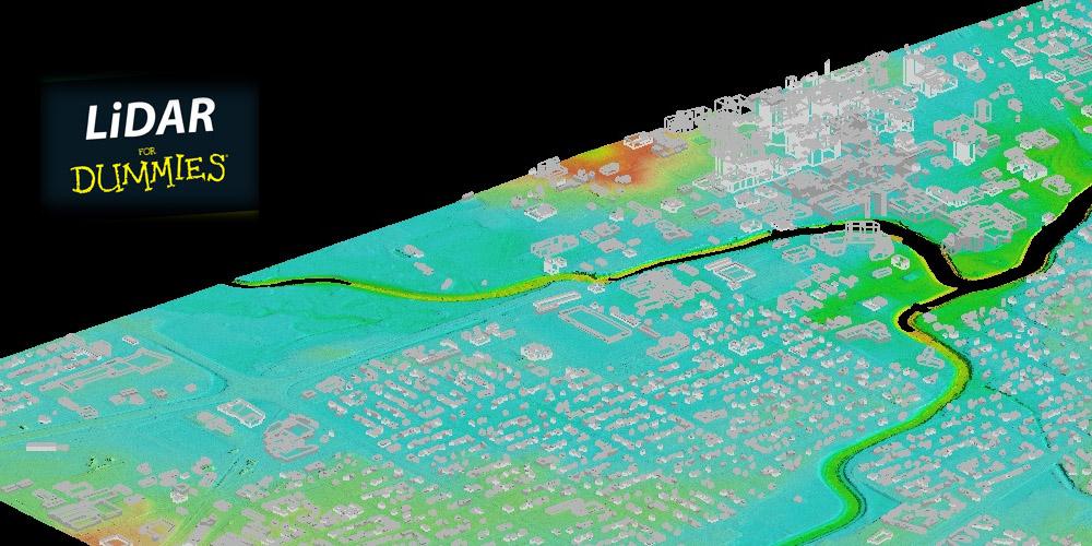
It’s important to note that the LiDAR solution that you use for data collection (whether it’s terrestrial, mobile, or high altitude aerial) is dependent on the project itself. For example, roadway resurfacing may benefit more from terrestrial or mobile scanning with high order x/y/z survey control monumentation for data calibration, while a use case such as a flood plain analysis would be better served with high aerial data collection.
Learn More
 For more specifics on the pre-processing and processing of LiDAR data, download this free ebook – LiDAR for Dummies – which spells out the basics of LiDAR, including what it is, how it works, more about the main capture techniques along with some details about how LiDAR is used and how it will help you pinpoint different features in the environment.
Related Articles
- How Government Agencies are Using LiDAR to Cut Costs Across Hundreds of Use Cases
- Fusion of LiDAR 3D Features with Elevation Data Improves Mapping Applications
- What is LiDAR? How can you use it? Let us make it simple
- 12 Things you Need to Know about LiDAR
Related Blog Posts


