Free White Paper: DOTs Explain How They’re Transforming Transportation Infrastructure Design

According to the McKinsey Global Institute, roads are the world’s top infrastructure segment in terms of investment. Here in the U.S. increasing traffic and an aging infrastructure is making it more important than ever to build new or rehabilitate existing transportation systems. These projects are becoming increasingly larger and complex, yet funding levels have continued to drop and traditional design methods aren’t cutting it anymore.
For instance, departments of transportation (DOTs) have little time or money to waste on outdated 2D paper plans and proposals to gain approval and consensus on roadway projects. When it comes to aligning technical and non-technical stakeholders on the best design option to pursue, charts on easels and 2D plans only engineers can understand are woefully inadequate.
In part, it’s this urgent need to dramatically accelerate the bid, proposal and preliminary design processes and manage the scale for all infrastructure projects that led Autodesk to launch Autodesk® InfraWorks™ 360.
InfraWorks 360 provides breakthrough 3D modeling, visualization technology and cloud capabilities for desktop, web, and mobile that goes beyond traditional CAD and GIS platforms and supports Building Information Modeling (BIM) workflows.
Check out this new white paper which discusses how DOTs, including New Mexico DOT, California DOT and Alaska DOT, are going beyond traditional CAD platforms to design in context, better communicate design intent, accelerate approvals and improve highway safety.
It’s free to download here.
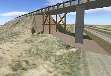
Featured image courtesy of New Mexico Department of Transportation.
Related Blog Posts


