As the Waters Rise, Flood Simulation Tools Can Help
As global temperatures rise, extreme downpours can result in flash floods that put a catastrophic strain on U.S. infrastructure. In fact, a new study from Nature Climate Change and reported by The Guardian, suggests that by the century’s end, storms that now occur once a season (like the Louisiana flood of 2016) could happen five times a season – a 400% increase.
Translate that into rainfall counts and we’re looking at 70% more rain per storm than we experience today. One of the severest consequences of such events is the impact on infrastructure – roads, bridges, drains, subways, etc.
Heavy rains in the north-east U.S. have already risen by 71% and The Guardian reports that intense rainfall events will increase across the country, impacting the Gulf and Atlantic states hardest.
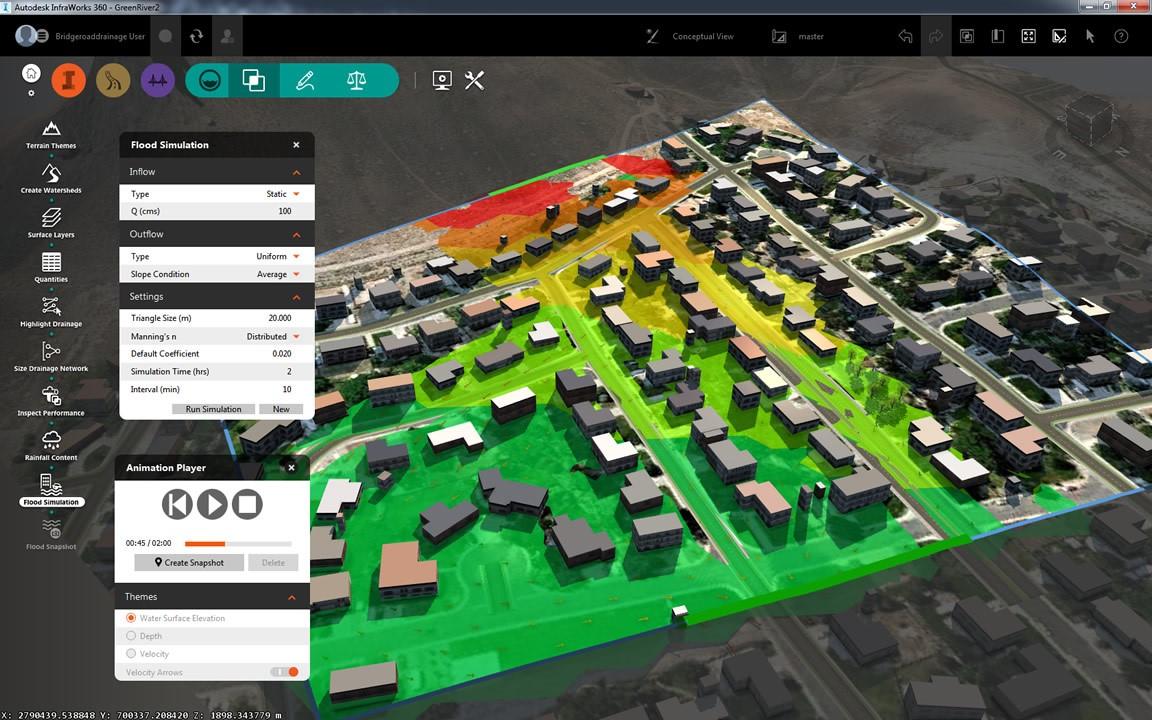
It’s no surprise then that model-based immersive flood analysis and simulation tools are becoming mainstream. Using software like InfraWorks 360 and Hydronia RiverFlow2D, a collaborative effort between Autodesk and Hydronia, InfraWorks 360 users have the ability to simulate, visualize, and animate 2D flood events directly in the Autodesk InfraWorks 360 model environment while utilizing the Hydronia RiverFlow2D computation model. It’s a powerful combination that supports several use cases, including:
• 2D river hydraulics simulation
• Dam-break hydraulics simulation
• Floodplain risk assessments
• Coastal and urban flooding
• Storm surge and sea level rise
Check out a demo of the capabilities of the flood simulation at work below.
Related Blog Posts


