Taking Gov 2.0 to the Next Level: Making Geospatial Technology Viable and Actionable
Virtual USA, Virtual Alabama, and Virginia Interoperability Picture for Emergency Response (VIPER). What do these three geospatial tools have in common? They are all geospatial emergency management tools that are making the promises of Gov 2.0 a reality.
As I’m sure you’re aware, Gov 2.0’s purpose is to socialize government services, processes and data through IT. So what does this mean for geospatial technology?
I recently read an article entitled, Geospatial tools offer killer app for Gov 2.0 that discusses the future of geospatial technology and the direction it must head in order to stay viable. That direction, according to the article, is making the data actionable. In other words, designing applications that keep the end user in mind, providing for the accessibility and use of that data by both the data gatherers and end users, and making sure the collaboration between the two is sustainable.
But how is this achieved in best practice?
We can already see this in action in tools such as Virtual Alabama and Louisiana Earth, both of which use Google Earth Enterprise to create a visualization tool to assist with emergency planning and preparedness. This has lead to a new initiative, Virtual USA, which expands on this technology to make state and local government information usable on a national level so that critical information can be accessed by those who need it most.
The collaboration of Virtual USA is yet another step forward in the evolution of geospatial data. The question now is: Once it is here, will it make us safer as a nation? My answer, yes. What do you think?
Related Blog Posts
Buildings, CAD General, Digital Design, Infrastructure, State & Local Government
Artificial intelligence (AI) is making its mark on the water industry, powering intelligent operations using machine learning to optimize resource use and operational budgets for organizations. Here are 10 ways AI is already changing the water industry, from business innovations that save money and make work more efficient to helping combat global water challenges by lowering overall water consumption.
Mahtab Barazandeh

Cybersecurity, Digital Design, Market Intelligence, State & Local Government
On December 12th, 2024, The National Association of State Chief Information Officers (NASCIO) released its 2025 annual top 10 priorities list identifying the most pressing technology and policy issues that state CIOs are prioritizing for the upcoming year.
Yvonne Maffia
Buildings, Business Applications, CAD General, Digital Design
Organizations are constantly looking for ways to gain an edge in the market whether through innovation, efficiency, or services. By transforming how you build from planning, design, build through to operate phases, owners can stand apart and achieve greater return on investments.We are excited to launch the blog series dedicated to demystifying Autodesk Construction Cloud for Design & Manufacturing! This blog series is supported by expert insights from Autodesk Principal Technical Solutions Executive for EMEA, Ives Veelaert.
Kristina Poluyanova
Buildings, Business Applications, CAD General, Digital Design, Federal Government, Infrastructure, State & Local Government
Passed in 2021, the Bipartisan Infrastructure Deal, or Infrastructure Investment and Jobs Act, is a massive investment in America’s infrastructure that’s creating a wave of opportunities for AEC firms. With billions of dollars allocated for infrastructure projects, many firms have secured funding and are preparing for significant growth.
Darian Burks

Channel Partners, Digital Design
This interview was originially posted by GovDesignHub here.
Brandon Norris

Digital Design
Article authored by Dan Williams and originally posted to GovDesignHub here.
On April 6, 2021, Autodesk Vault 2022 was released. And I have to say that it is easily the most feature-rich release in recent memory.
Brandon Norris

Digital Design
Prior to 3D printing’s arrival on the manufacturing scene, the US military supply chain was often met with lengthy and arduous timelines for critical asset production. This not only stalled the manufacture and repair of essential equipment within the military supply chain, but it also impeded military readiness, and with high price tags to boot.
Brandon Norris

Digital Design
Out of sight, out of mind. It’s all too easy to forget about asset maintenance when the assets themselves aren’t right in front of you. During the COVID-19 pandemic, this became more evident as employees went home and logged into a virtual workplace instead of coming to a physical space.
Carly Bell
Digital Design
Article originally posted to the GovDesignHub here.
Brandon Norris

Digital Design
Article originially posted to the GovDesignHub here.
Brandon Norris
Digital Design
Another release of Civil 3D just became available, just as you probably finished installing the latest 2020 “fix.” That was somewhat sarcastic, but I do some see much needed improvements to Autodesk Civil 3D 2021 and all other 2021 products. But we can’t just look at what’s new in our hero product, but all other complimentary products as well, so I will briefly mention a few of those.
Civil 3D Version Interoperability
DLT Solutions

Digital Design
A new version of AutoCAD is now available.
DLT Solutions

Digital Design
From design, construction, to facilities management, the need for closer ownership is clear.
Shaun Gaffrey

Digital Design
The future of government offices, buildings, and installations is about to change dramatically. When workers return to work or building owners make changes to how they work, they can expect offices to be designed differently to minimize the spread of germs and make people feel safe. But we can also expect sanitation to step up significantly.
Caron Beesley
Digital Design
Digital design data is a big data business. It requires secure management and storage, versions need to be stringently controlled, and teams need to access files readily so they can share that data with stakeholders.
For too long, however, designers, engineers, and CAD managers have relied on traditional document management systems, like network drives, to achieve this. While they do a great job with office documents, those same solutions don’t work well with today’s design files and models, for several reasons:
Caron Beesley
Digital Design
AutoCAD 2021 is here!
On March 25, 2020, Autodesk announced the release of AutoCAD 2021 the latest iteration of its flagship software first released in 1982. A key update includes a new integration with Google Drive allowing users to access their designs wherever they are as well as performance enhancements.
Let’s break down what’s new.
Caron Beesley
Digital Design
Article originally posted to GovDesignHub here.
If you’ve made the move from AutoCAD to Revit, congratulations. But what do you do with that huge library of details that you amassed over years of working on CAD projects? As you transition to Revit, recreating AutoCAD details is a hassle and trashing them is out of the question.
The good news is, you can use details right in your Revit project – straight from AutoCAD.
Caron Beesley

Digital Design
Article originally posted to GovDesignHub here.
Building and maintaining our nation’s infrastructure is a critical responsibility of the public sector. Yet, year-after-year, the U.S. continues to rank low on the American Society of Civil Engineers (ASCE) Infrastructure Report Card.
Caron Beesley

Digital Design
Smart cities have been called “the future of urban development”, but what is a smart city and what does it mean to digital designers and engineers?
Kirk Fisher

Digital Design
Autodesk made further strides into its quest to empower the technological transformation of the construction industry with its recent acquisition of BuildingConnected – a leader in preconstruction tools that help building owners and contractors streamline their operations and communicate better.
Caron Beesley

Big Data & Analytics, Digital Design
The state of our nation’s infrastructure is grim. The most recent report card from the American Society of Civil Engineers (ASCE) gave U.S. infrastructure an overall score of “D” for “poor” or “at risk”.
Caron Beesley

Digital Design
If your job involves capturing existing field conditions as part of the design and construction process, you’ll know it’s a tedious, manual, often analog and inaccurate process, which often leads to costly re-work.
Whether you’re renovating a building or involved in a large-scale infrastructure project, the process goes something like this:
Holly Chapman

Digital Design
As any surveyor or field engineer knows, capturing existing field conditions for an infrastructure project or building renovation is a tedious, manual, often analog, and inaccurate process – not to mention dangerous.
Renovations projects are a particular challenge since the infrastructure or building may be decades old and designed before the age of digital blueprints. You’re almost guaranteed to start a project using static 2D image documentation of existing conditions. Verifying and updating these manually is a lot of leg work.
Holly Chapman
Digital Design, Uncategorized
When we launched GovDesignHub in the spring of 2018, we had one goal in mind – to address the lack of resources, discussion, and analysis available online for those who practice in government digital design ecosystem.
Today, we’re proud to be the only website that showcases government design projects and the technology used to support them and deliver content to help public sector organizations accomplish their missions.
In the words of one of our top contributors, Lynn Allen, of Autodesk fame:
Holly Chapman

Digital Design
What do a Facebook data center, a railway, an expressway, an office building extension, and a cancer center have in common?
These and other global projects are recipients of this year’s AEC Excellence Awards in recognition of how they’ve embraced technology to reimagine the processes of design and construction.
Holly Chapman

Digital Design
Want to win a free pass to Autodesk University (AU) 2018? Earlier this summer, we announced that we’ll be awarding a full conference pass for you or a chosen nominee at your agency or department to attend Autodesk University 2018 in Las Vegas from November 13-15th.
Holly Chapman

Digital Design
Autodesk introduced its Autodesk Collections a couple of years ago and there’s never been a better time to make the switch from individual product subscriptions to a collection. Thanks to a limited time offer from Autodesk, your agency can save 20% on the remaining months of your existing term if you switch by October 25, 2018.
But what’s the buzz about collections and why make the move?
Why Make the Move to Autodesk Collections?
Holly Chapman

Digital Design
It’s that time again, when agencies rush to spend their remaining year-end budget before the September 30th “use it or lose it” deadline. One-third of federal budget dollars are spent in the last quarter of the year, often in a wasteful manner. But for those in the field of digital design – there are many opportunities to make value-based investments using taxpayer dollars before it’s too late.
1. Training
Holly Chapman

Digital Design
Download the eBook here!
If you’re one of the millions of people who’ve been lucky enough to hear Lynn Allen present, you’ll know her as the queen of AutoCAD tips and tricks and all-round Autodesk technical evangelist, but she also knows quite a bit about the latest disruptive technology – BIM.
Caron Beesley
Digital Design
Building information modeling (BIM) is poised for greater adoption by federal, state, and local government agencies. In Wisconsin, for example, publicly-funded projects over $5 million are required to incorporate BIM and 3D software from initial planning concepts to bidding documents and project closeout. Many DoTs, including MassDOT, FDOT, and CALTRANS are also embracing BIM for infrastructure projects.
Grace_Bergen

Digital Design
It’s hard to imagine a world without digital. But as you look around you, much of the physical world was designed and constructed using traditional 2D blueprints and is yet to be captured in a digital format. This creates a challenge for AEC professionals to incorporate these as-built designs into re-build or renovation projects.
Traditional imaging techniques like photogrammetry aided in this process by allowing engineers to piece together photographs of as-built conditions and weave in GPS coordinates to create interactive 3D models, see below:
Grace_Bergen
Digital Design
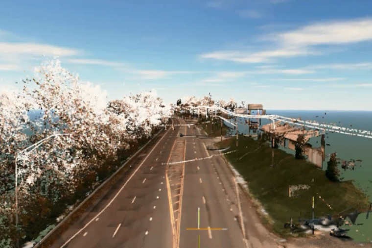
As the demand for geospatial data grows, mobile mapping technology has advanced significantly in recent years allowing AEC professionals to collect extremely accurate, precise data from LiDAR sensors mounted on the back of a vehicle while driving at speeds up to 70 miles an hour.
DLT Solutions

Digital Design
Rich3D, GovDesignHub explain how they delivered complex helicopter and military vehicle 3D virtual training via a ubiquitous tool – an Adobe Acrobat document.
The U.S. Marine Corps and the U.S. Navy need highly interactive 3D tools to deliver complex animated virtual training and simulation environments for helicopter pilots, crane operators and other professionals. And government contractor Rich3D uses a variety of 3D design tools to develop and deploy the interactive training environments they need.
Grace_Bergen

Digital Design
For government organizations and municipalities, ensuring everyone is on the same page in terms of core competencies is an essential prerequisite to the success of any digital design or engineering project. With the pressure to do more with less, knowledge gaps can stymie team productivity, lower your return on investment in software tools, and make everyone’s lives a lot more difficult.
Grace_Bergen
Digital Design, Uncategorized
New York City Department of Design and Construction (NYC DDC) handles some of the most exciting and dynamic architectural and infrastructure challenges in the world.
Grace_Bergen

Digital Design
Bolstering the U.S. manufacturing sector is a message that has played into election campaign promises and White House administration policy for decades. The reality is a different story.
Grace_Bergen
Digital Design
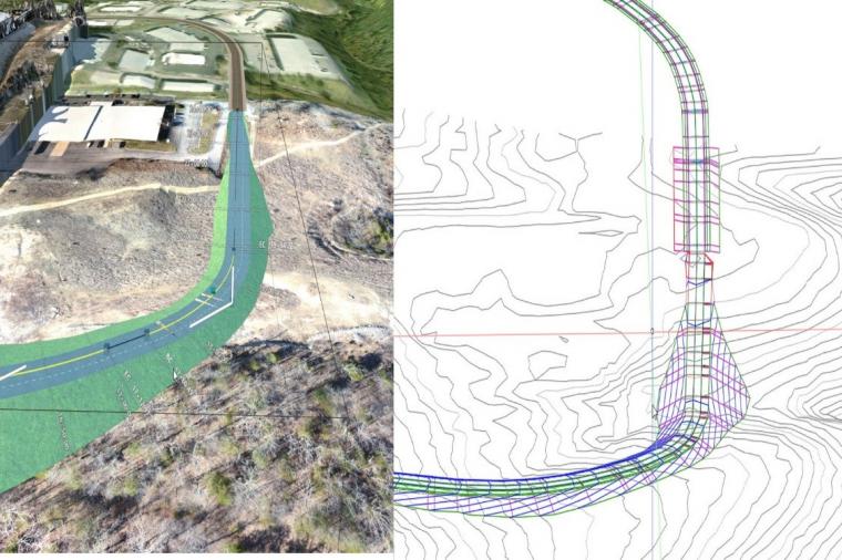
Civil 3D 2019 is here. But what’s new and should you make the upgrade? Look out for webinars, blogs and insights from the civil community in the coming weeks that will no doubt make the case for the 2019 release. In the meantime, if you’re looking for a quick digest of what’s new and notable, we’ve pulled together thoughts and appreciations from a couple of industry experts who’ve already had a sneak peek at Civil 3D 2019.
Here’s what they’re telling us:
Civil 3D 2019 – “Things I Appreciate Out of the Gate”:
DLT Solutions
CAD General, Digital Design, Technology, Tips and How-Tos
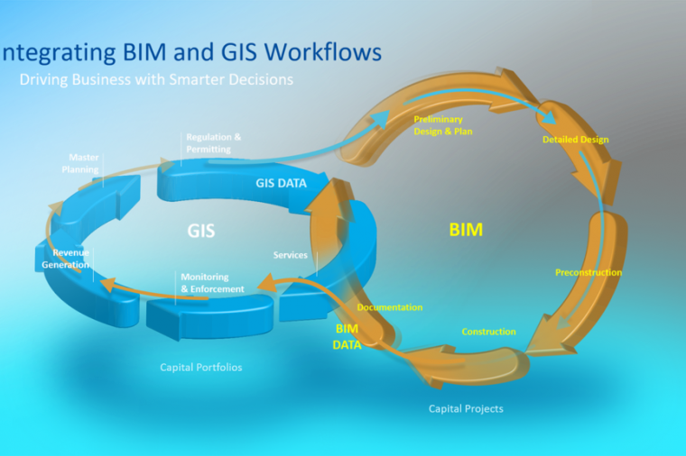
Late in 2017, Autodesk and ESRI announced a new partnership to “advance infrastructure planning and design”. The relationship was positioned as helping build a bridge between building information modeling (BIM) and GIS technologies.
But what does the relationship mean for government infrastructure projects?
Taking 3D Contextual Design to the Next Level
DLT Solutions

Digital Design, IT Perspective, News, Technology, Tips and How-Tos, Uncategorized
The CAD and digital design sector is vast and growing at breakneck speed. It’s expected to reach $11.21 billion by 2023.
Many end-use industries such as automotive, aerospace, entertainment, industrial machinery, civil and construction, electrical and electronics, pharmaceutical, and healthcare, consumer goods, and others, widely use CAD and 3D design-based tools in their development processes.
DLT Solutions

CAD General, Digital Design, Technology, Tips and How-Tos
The holidays have arrived early to the government CAD community. Lynn Allen is coming to town and online in a city near you!
DLT has partnered with everyone’s favorite Autodesk evangelist and tips and tricks queen to bring you a series of tech breakfasts and webinars.
Starting this May and continuing over the next few months across the U.S., Lynn will share what’s new with AutoCAD 2019 (aka One AutoCAD) and dive into trends and happenings in the world of government digital design.
Here’s what May has in store:
DLT Solutions
CAD General, Digital Design, IT Perspective, Technology, Uncategorized
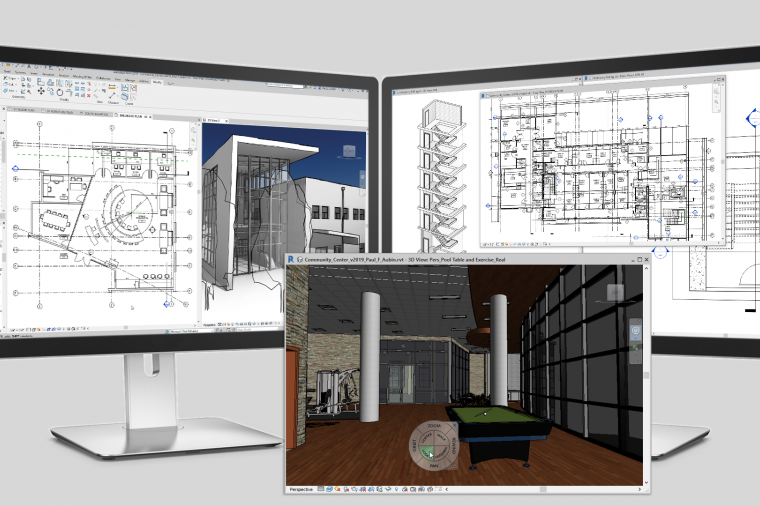
Aside from developing one of the sought after building information modeling (BIM) software in the industry today, you’ve got to hand it to the Revit product managers over at Autodesk—they listen.
Grace_Bergen
CAD General, Digital Design, Technology, Uncategorized
Whether you’re a civil engineer, CAD manager, or anyone working on a digital design project, one thing is certain – you’re never the sole collaborator in the process. Contractors, AEC firms, field personnel, even facilities managers, have their hands in the mix too. And that creates a problem for version control and the potential for incorrect information in the field. How do you know you’re working with the most current information? If you’re using traditional non-digital workflows, it’s a problem you likely encounter once too often.
DLT Solutions
Digital Design, Technology, Tips and How-Tos, Uncategorized
If you’re fairly new to Autodesk Revit and looking for ways to quickly get up to speed, Autodesk put together a great webinar that offers tips and tricks to get the most out of your user experience. Topics included:
• How does it differ from AutoCAD?
• What do I need to know to get started?
• What are some best practices for working in Revit?
• What are families and how do I use them?
• Where to learn more and how to get support when problems happen
Grace_Bergen
Buildings, CAD General, Digital Design, Infrastructure, Technology
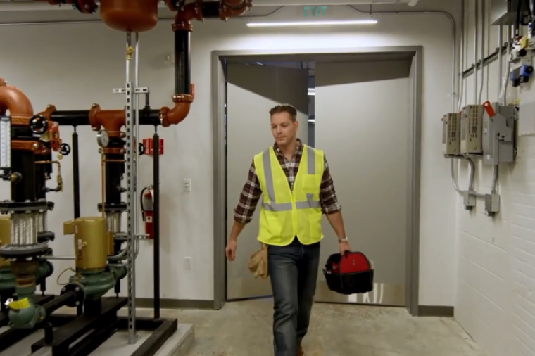
The use of building information modeling (BIM) data by building owners and facilities managers is on the rise, a survey by DLT partner, IMAGINiT Technologies reveals. Compared to 2016, the percentage of owners integrating BIM data into facilities management (FM) systems has increased by almost 9%. Yet challenges remain. Many organizations aren’t prepared or equipped to make the process and technology changes required for BIM adoption.
Grace_Bergen

Buildings, Digital Design, Infrastructure, Transportation
Urban development is a big challenge for governments and project owners. Urbanization, combined with overall population growth, could add another 2.5 billion to the world’s urban centers by 2050. For the infrastructure sector, this means providing the essential utilities and transportation systems to support these dense over-crowded areas – while doing more with less.
DLT Solutions
Digital Design
It doesn’t matter whether you work in the federal, state or local government, rolling out any new software to your workforce can be a challenge. This is especially true of CAD software. Oftentimes, a department may upgrade from AutoCAD to a discipline-specific tool like AutoCAD Civil 3D or Revit, or depart radically from an old way of doing things with new software.
Team leads or CAD managers face several challenges. Standards must be reviewed and modified, staff must be trained, trial projects must be identified, and user/management expectations met.
Grace_Bergen
Digital Design
Did you know that construction is anticipated to be the largest use case for commercial drones?
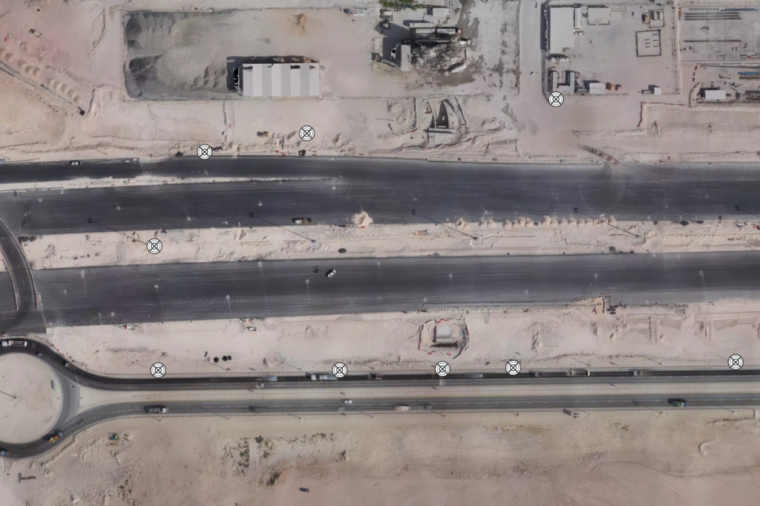
Drones can collect a site’s progress with a degree of accuracy previously unseen in the industry and reduce the amount of building site materials that end up in landfills. Furthermore, that sensor data can be turned into 3D models, maps, and volumetric measurements (which can help monitor and track costly gravel and sand inventory).
Grace_Bergen

Digital Design
Making the move to AutoCAD Civil 3D is a big step up for many agencies and public sector teams. Whether you’re coming off using Land Desktop or AutoCAD for your civil infrastructure projects, Civil 3D can seem like a daunting leap forward, despite the many benefits the software brings in terms of greater efficiencies, long-term cost-savings, and reduced errors. It’s something we often hear from our government clients.
DLT Solutions

Digital Design
We frequently write about BIM principles, use cases and best practices here on the DLT blog, but one area that often goes neglected in BIM are the soft skills or people skills. What is the role of a BIM manager anyway? How can you better achieve your project goals as design technology managers or support your personnel?
Caron Beesley
Digital Design
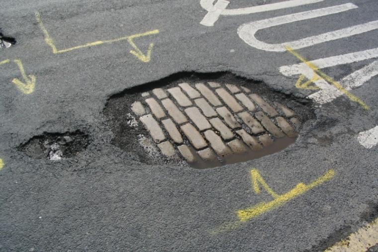
Look out for the pot hole! Did you know that one out of every five miles of highway pavement is in poor condition and in need of rehabilitation? If you’re a civil engineer, you’re probably not surprised. The bulk of highway system funding goes towards highway repair, and with good reason.
Grace_Bergen