Dorado County, CA, contains more than 1,100 miles of road. Nothing unusual about that, but when you consider that these roads stretch from the suburbs of Sacramento to the shores of Lake Tahoe, then you’re dealing with some interesting terrain.
It’s the job of the El Dorado County Department of Transportation (EDCDOT) to manage these roads and highways in line with California’s stringent safety and environmental standards.
As with any transportation agency, EDCDOT needed a way to reduce costs and time-to-build, without compromising quality. Several years ago, the agency explored building information modeling (BIM) – a period when BIM was still perceived as an architectural process. But BIM has many benefits for those involved in transportation design.
BIM’s integrated process enables civil engineers to create coordinated, accurate digital models of transportation infrastructure projects early in the design process. EDCDOT engineers hoped to use these models to more quickly model and analyze multiple design scenarios, thereby minimizing time-consuming and costly errors, while improving overall design quality and project completion time.
Their product of choice was AutoCAD Civil 3D, again not a tool that springs to mind when you think of BIM. Civil 3D, however, is a BIM solution specifically built for civil engineering design, analysis and simulation.
BIM for Highway Design – Taking the Pain out of Traditional 2D Designs and Processes
One of the first projects that EDCDOT tackled using Civil 3D was to complete a series of modifications to a road design project in a small, but rapidly growing, mountain community in the foothills of the Sierras. This rapid growth had spurred traffic congestion and accidents.
Widening the road and adding traffic signals proved challenging using traditional 2D design method. Change requests and add-ons during the review process would have taken months to evaluate.
However, with Civil 3D, engineers were able to accelerate the redesign process. Using the original drawings as a basis, they were able to quickly build a 3D model (aka a BIM) of the existing roadway corridor – something they could use as the foundation for multiple design scenarios.
“For example, when we were evaluating utility configurations, Civil 3D helped us turn weeks of work into a three-to-four-hour project,” said EDCDOT principal engineering technician Steven McVey. “It was just a matter of moving the necessary elements until the design was optimized, staying within right-of-way and easements and avoiding environmental considerations.”
The team was even able to conduct a feasibility study of where to locate utility piles as far away from the modification site as possible. Using Civil 3D this process was easy.
“I could immediately see any conflict with the pole, line, and new grading,” says McVey.
The model also helped engineers to go back and check how accurate their original 2D plans were. Using the model they could tweak the grading to better fit the location. “Civil 3D helped us create a higher-quality design and reassure the County Board that the proposed modifications would actually work,” says McVey.
Thanks to Civil 3D, EDCDOT stayed on schedule. “We were able to incorporate all of the new design work into the original plans and send them out to bid on schedule,” says McVey.
Read the complete EDCDOT case study.
[caption id="attachment_5832" align="aligncenter" width="1152"]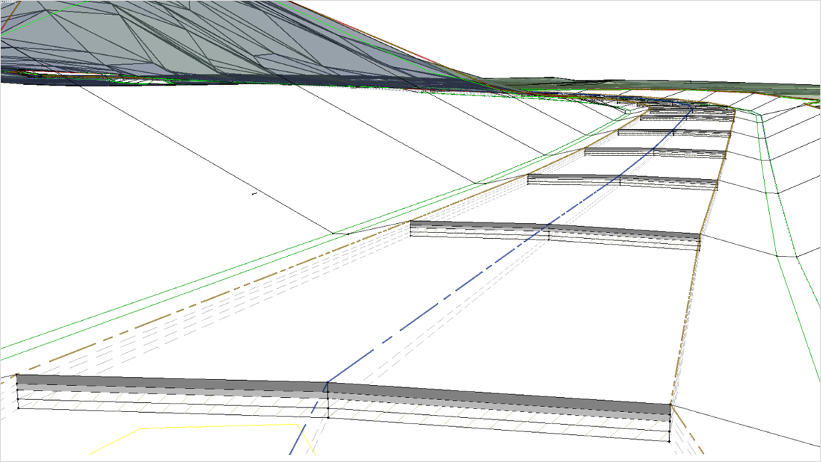 Corridor-design tools in Civil 3D[/caption] [caption id="attachment_5833" align="aligncenter" width="1152"]
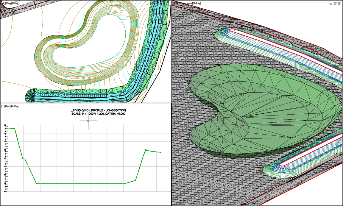 Civil 3D terrain models for grading[/caption]
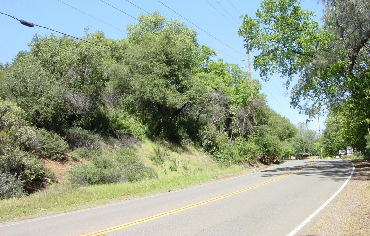
Featured image courtesy of EDCDOT and Autodesk
Related Blog Posts


