How Technology can Help Predict and Prevent the Impact of Hurricanes
The financial impact of flooding on U.S. coastal cities is crippling and with rising sea levels and coastal populations, it’s anticipated to get much worse.
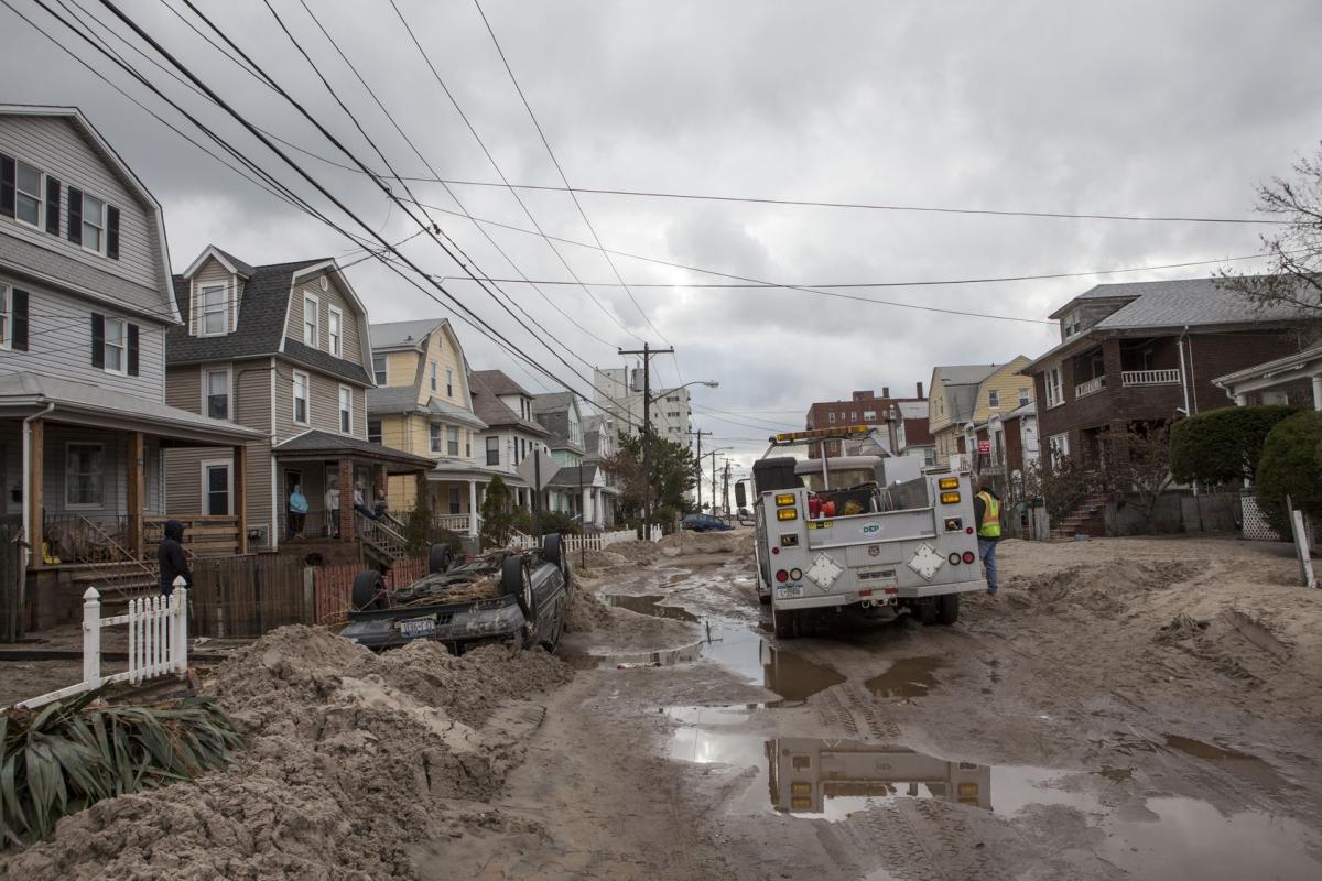
When Hurricane Sandy hit coastal New Jersey and New York in 2012, it caused an astonishing $70 billion in damages. One of the worst affected areas was New York City, where the East River overflowed its banks flooding vast portions of Lower Manhattan. A 13+ foot storm surge also devastated seven subway tunnels and the Ground Zero construction site. To top that off, over 10 billion gallons of raw sewage was released into the waters around New York and New Jersey.
So what can design technology do to prevent such catastrophes in the future? In his recent blog for BIM on the Rocks, Steven Costa of Microsol Resources shared some fascinating examples of design software at work in his quest to show “How Technology and Big Data can Help Predict Impacts of Hurricanes” shared by the BIM on the Rocks blog.
To start with, Costa first quantified the impact of Sandy with visual examples generated using AutoCAD Civil 3D and Adobe Photoshop:

Costa went on to model the flooding impact in InfraWorks 360, taking advantage of the new Project Boulder for InfraWorks 360 (now available on Autodesk Labs). As Costa explains, “this technology gives you the ability to create two-dimensional (2D) flood simulations within InfraWorks 360 models.”
Using data derived from the NYC Open Data website – a clearinghouse for free GIS data. Costa’s sought to create a full scale simulation of what happened when Sandy hit Lower Manhattan. But that’s not all, Costa wanted to use this data to inform a design that would protect the region from future storm surges. Using the GIS data as “a basis for a preliminary design that addresses a very real problem,” Costa reviewed winning proposals from the he Rebuild by Design design competition and settled on one from BIG. “One solution in particular I loved was the solution proposed by BIG (Bjarke Ingels Group) in a collaborative effort with a number of planners, architects and engineers known as the “Big U” or “Dryline,” said Costa.
After reviewing some of the public documentation from BIG, Costa used Civil 3D and 3ds Max to create a design simulation that could prevent further storm surge flooding. Then, using Infraworks 360 and the Project Boulder technology preview Costa created a timelapse video approximating the storm surge that impacted lower Manhattan during Hurricane Sandy. The exiting conditions were then examined in a side-by-side comparison with an approximation of the berms proposed in Bjarke Ingels Group design concept for the Dryline.
Here’s the result:
Learn more about what went into this project over on Steven Costa’s guest blog on BIM on the Rocks.
Related Blog Posts


