Keeping Pace with Climate Change: Flood Analysis and Mapping Tools
Flood risk assessment and mitigation is a critical part of any civil engineer’s job. After Superstorm Sandy devastated the New Jersey/New York shore in 2012, it was discovered shortly thereafter that federal flood maps drawn up by FEMA were wrong. Unfortunately for many home and business owners, developers relied on FEMA’s assessment of risks when they built new homes near the water and property owners made decisions about whether to buy flood insurance based on those maps. Those maps also didn’t account for climate change and its impact on flood risk.
Inaccurate Maps and Models take the Heat
When Sandy hit, thousands of buildings incorrectly identified as being outside the flood zone were damaged.
According to Propublica.org:
“During a push to modernize flood maps in the mid-2000s, FEMA decided to save money in New York City and much of the rest of the country by digitizing old flood maps without updating the underlying information, rather than using new technology to create more accurate maps.
The agency changed course in 2006, but didn’t release maps with better elevation data and more accurate storm-surge models until months after Sandy – too late to help New Yorkers…”
New York isn’t alone. According to the National Resource Defense Council, river, country, and coastal flood maps are also out of date.
Flood Analysis and Risk Assessment for Planners and Engineers
Cartography aside, the technology to aid flood analysis, modeling, and risk assessment has been in place for some time. For example, AutoCAD Map 3D is a model-based GIS and mapping software that lets you perform flood analysis with overlay tools.
AutoCAD Civil 3D design and documentation software also includes a river and flood analysis module that automates water analysis and mapping functions and lets you automatically generate floodplain and floodway maps from FEMA and other agency submittals.
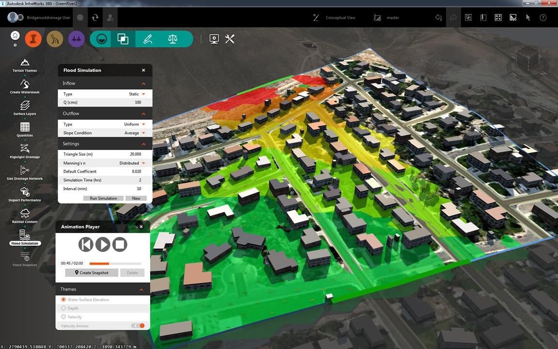
InfraWorks 360 preliminary design software, which complements Civil 3D, includes a flood simulation feature that allows you to perform flood analyses and simulations in your models and aid in civil planning projects. Flood animations show changes in water surface elevation, water depth, and velocity over time. You’ll need to download Hydronia’s RiverFlow2D plugin for InfraWorks 360, so that you can simulate, visualize, and animate 2D flood events directly in your InfraWorks 360 models, and even save snapshots of different flood scenarios. Check out this blog from BIMagination for step-by-step guidance on how to run these simulations.
Related Blog Posts


